| Jeff Walker gives us a brief history of the pipeline |
|---|
 |
Alaska Pipeline in Fairbanks
(Posted August 21, 2000, © Herbert E.
Lindberg)
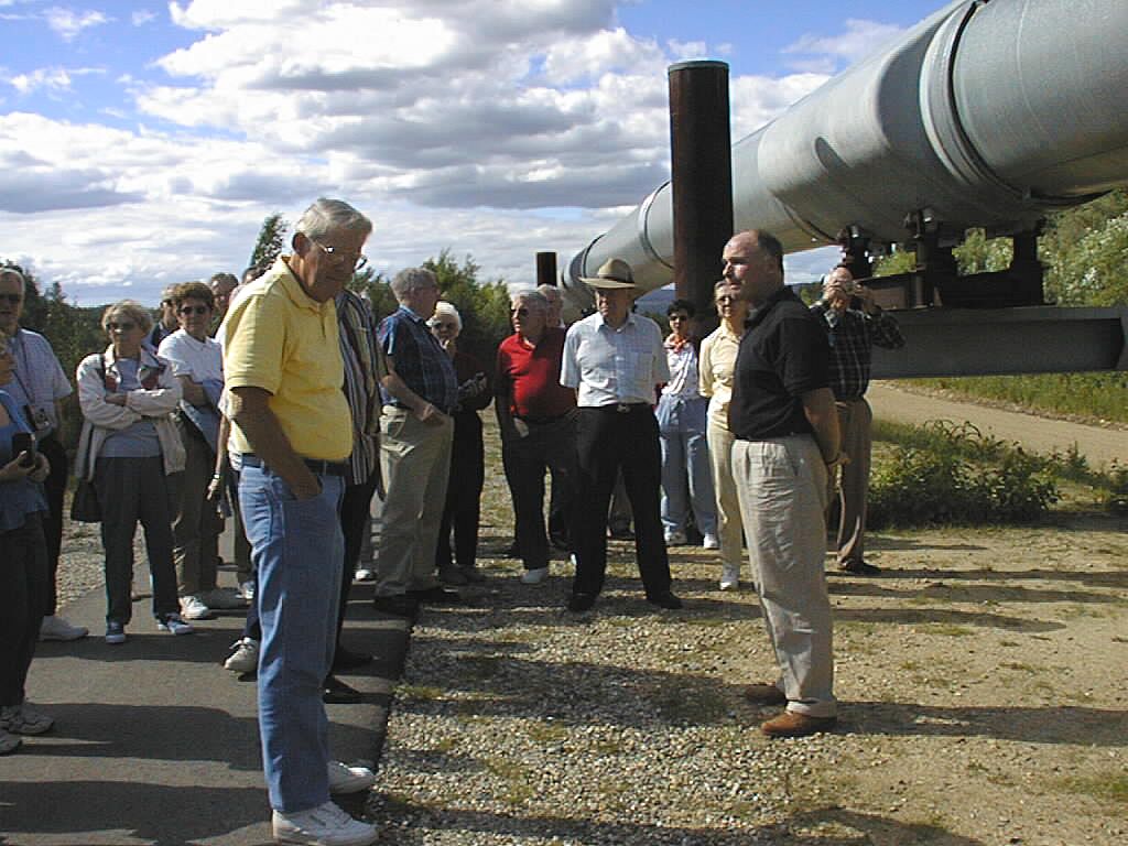
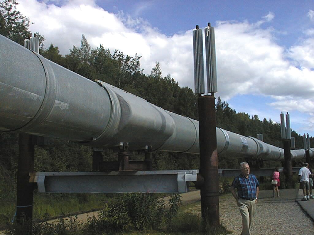
Day 2 (July 15) began with breakfast at the Space Needle, but the main business of the day was to get to Fairbanks, Alaska. After breakfast the motor coach took us back to SeaTac Airport for a 3-hour flight to Fairbanks, leaving at noon. Another coach took us from the Fairbanks Airport to the Westmark Inn, but stopped first to view the Alaska Pipeline. In the picture below, Jeff (black shirt) stands by a section of the pipeline to give us a brief history. Tom Klinger, in the yellow shirt, seems to have his mind on other things. Peter Cook, with the fedora, looks like an FBI agent in a B movie!
| Jeff Walker gives us a brief history of the pipeline |
|---|
| |
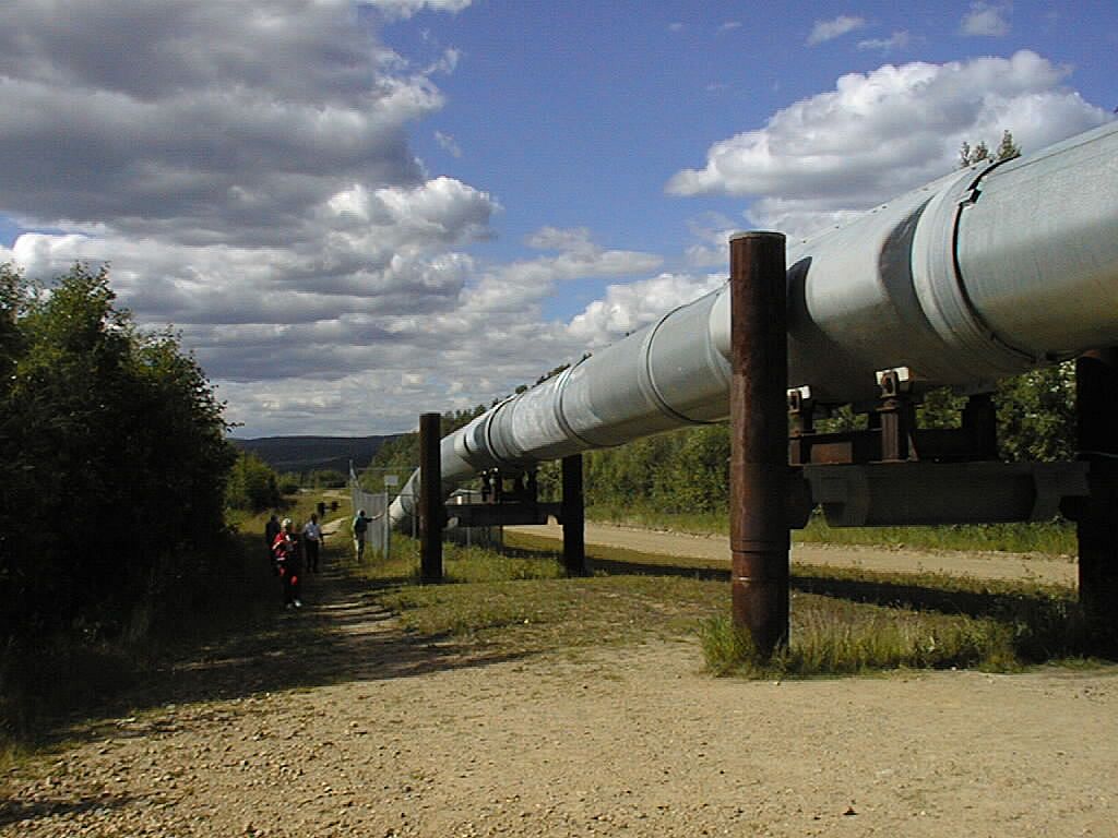
This next picture gives a better view of the pipeline section, sans people.
| Transition from underground to aboveground sections of the pipeline |
|---|
 |
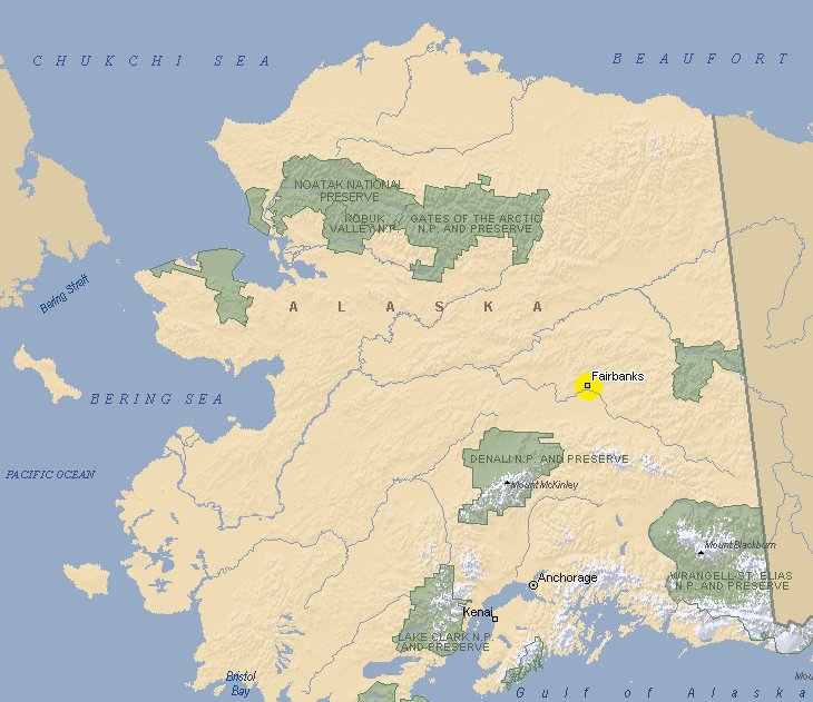
The pipeline was constructed from April 29, 1974 to June 20, 1977, by a crew that totaled 70,000 and peaked at 28,000 in October, 1975. The pipeline traverses 800 miles from Prudhoe Bay on the arctic circle to Port Valdez on Prince William Sound. At an 8 billion dollar cost, it was the largest private construction project, anywhere. In the map below, the pipeline follows a roughly straight line parallel to Alaska's eastern border, bulging west as it approaches Fairbanks and then proceeding to Prince William Sound, which is the multi-fractaled body of water at the northern extreme of the Gulf of Alaska, southeast of Anchorage. Note the snow-covered mountains arcing around the sound -- we flew over them in float planes on Day 6, a day to remember.
| Alaska, the Last Fontier |
|---|
 |
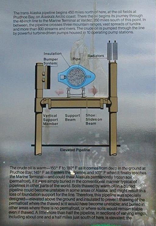
Quoting from a plaque in downtown Fairbanks, which was the project's central staging area:Construction crews, or "spreads," as they were called, laid pipeline across tundra, over high mountains, under or over 34 major waterways and some 800 other rivers and streams. They faced challenges seldom equalled in construction projects elsewhere, at Atigun Pass, Thompson Pass and Keystone Canyon, for instance, where even some veteran workers turned away, and even the best of them were tested. They faced falling rock, snow slides, terrain so steep the bulldozers were held by safety cables and welders were tied in place like mountain climbers to the pipe sections they were welding. They faced wind, cold, ravenous mosquitoes, rain, snow, hail, even, on occation, threatening wildlife.The plaque below gives more information and some of the operating features of the pipeline. (The scratches and discoloration are on the plaque, not the photo.) Among other things, the plaque explains that the oil is warm (about 155 şF to 180 şF as it comes in from deep underground at Prudhoe Bay, 146 şF as it enters the pipeline, and 103 şF when it finally reaches the Marine Terminal at Valdez) and could thaw the permafrost if the pipe were buried underground as in typical pipelines. That's why, in regions of permafrost, the pipe is elevated (about half its total length, in sections of various lengths). In addition, in some sections the vertical support members (VSM's; there are 78,000 of them) have a passive refrigeration system that disapates heat that flows through the support structure to the VSM's.
| Information Plaque at the Visitor Center |
|---|
 |
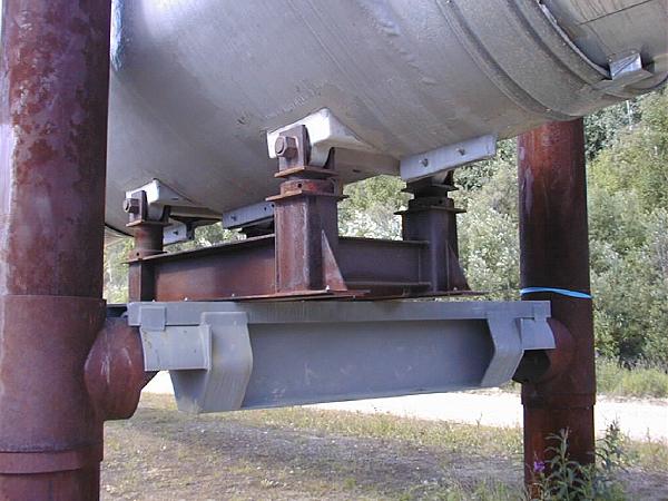
Finned radiators are attached to the tops of the supports to dissipate the heat. Anhydrous ammonia continually flows up through the radiator, down the supports, and then back up to the radiator. Further, the amount of heat transferred to the support structure is minimized by thicker insulated sections several meters long where the structures attach to the pipe. All these features are clearly seen in the photograph below. Pipe inside diameter is four feet.
| Attachment insulation, and passive refrigeration radiators on each support column |
|---|
 |
For the even more technically oriented, the picture below is a close-up of the earthquake-resistant support system at each pair of supports. Cross members are attached to the vertical supports, and a platform is attached to the pipe insulator section through four hinged links. However, the platform is not attached to the cross members. Instead, it slides on a teflon bearing between the platfrom and cross members. Only the downward weight of the pipe is supported. The earth can move several feet horizontally and the pipe will remain stationary. Severe up-and-down earth motions are partially isolated by slip-friction sleaves that can be seen at the attachments of the cross members to the vertical supports.
| Earthquake-resistant support system |
|---|
 |
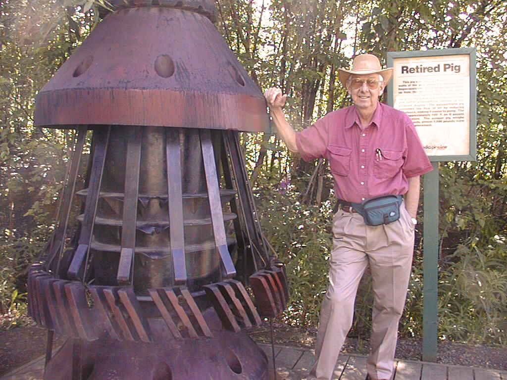
In everyday operation, the oil takes 6.2 days to traverse the pipe at an average speed of 5.4 mph. At present, the injection oil temperature at Prudhoe Bay is 116 şF. The temperature is 82 şF at the Marine Terminal in Port Valdez. Part of pipeline maintenance is to keep its inside free of buildup from impurities in the crude oil, which precipitate out from the warm oil to the cold pipe. This is done with "pigs" that are inserted periodically to ride through the pipe. In its early years, the accumulation was thick and solid, so the pigs were metal with sharp "knives" that scraped the pipe's inside surface as the pig went through the pipeline like a rotorootor. One such pig is shown below, but the sign "Retired Pig" could apply to me or the rotorooter. Today, plastic pigs are sent through the pipe every 4 to 6 weeks. More than 16,000 tanker loads have been filled with twelve billion barrels of oil, more than 20% of U.S. domestic oil production.
| Two Retired Pigs, one human |
|---|
 |
Well, that's more than most of you want to know. But let's face it, the pipeline is interesting mainly to engineering/science buffs. I know several readers who want to know all this, and more.
Continue to Gold Panning with Andy Wescott - - - Return to Alaska hub page - - - Return to Home Page Top